This two day course will consist of practical sessions on surveying slopes and contours to help with the development of the Summerbottom permaculture site at Broadbottom, near Hyde, Cheshire.
When: Saturday 01 November 2025 10:00 hrs
Day 3: Sunday 13 April 2025
Day 4: [node:field_short_event_date_s_:2]
Where: Warland Farm
Led by Angus Soutar and Keith Jarrett
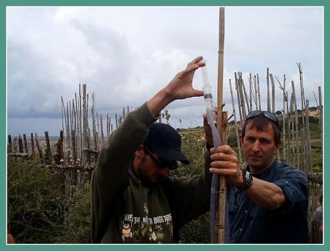
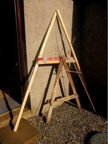
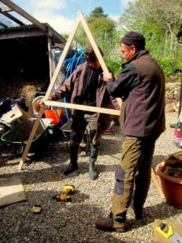
On the first day, we will use basic surveying techniques, including those using equipment constructed entirely on-site out of commonly available materials (no batteries required!). Participants will get “hands on” experience with this equipment. We will also be introducing some of the 20th Century versions of instruments such as the dumpy level and the inclinometer (still no batteries required). We will look at the various ways of establishing levels and contours on the site, leading to a layout for swales and diversion drains for future implementation.
You will learn how to construct and use an A-frame with a plumb line; a simple water level, a dumpy (optical) level as used by builders and other instruments to establish contours across the site.
This will be followed by a day on the 26th March where we will look at various ways of mapping the survey results. We will look at ways of representing the data, examining the different types of maps available as base maps and looking at the various overlays. Basic mapping techniques will be used to plot contours onto an existing site plan in the first stage of the design of a water distribution system for the site.
Book a place on this event
Bookings for this event will go through our partner CommEnt CIC and your payment for the event will be processed at their secure account with Stripe Checkout.